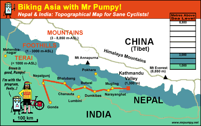
The Topographical Map
The Himalayas are the highest mountain range in the world, and from a cycling standpoint, diffcult.
Besides the obvious steep climbs (the higher you get, the steeper it gets!) and sometimes changeable weather conditions, oxygen depletion sets in at around 3,000 metres (above sea level) (10,000 feet), so any cycling above this altitude requires grit and determination.
Anything over 5,000 metres (16,000 feet) is pushing the envelope; at this altidude its hard enough to get on the bike, much less ride it up a steep incline.
Kathmandu to Lhasa (Tibet), Leh (Ladak) to Srinagar (Kashmir) and Pakistan to China over the Karakoram Highway are routes that run above 3000 metres. the Karakoram run pushing 5,000 metres at its height.
Not for newbies!
The Terai is a whole other proposition.
Running at an altitude below 1000 metres, the Terai is the rolling tropical flatland area that borders India, and it is, without a doubt, easy touring.
There's oodles of oxygen, no (really) big climbs,
the road is perfect, the traffic's thin and the locals, who don't see a whole lot of tourists, are easy going, friendly and trustworthy.
Its just a question of what you want...